Page 1 of 1
Trajectory Shapefile
Posted: January 17th, 2014, 2:00 pm
by ylbarnes
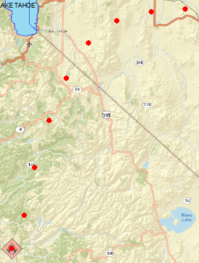
I am using the web based HYSPLIT model. The trajectorie in the shapefile came across as widely-spaced dots. How do I change that to connected dots, if there is such a way; and if not, how do I change the run spec setting so that the dots are closer together? Please see attached file for a visual clarification. Thank you for your help!

- 2013_WildFires_ArcMap.png (254.45 KiB) Viewed 1855 times
Re: Trajectory Shapefile
Posted: January 29th, 2014, 11:53 am
by glenn.rolph
There is a variable that can be set in the SETUP.CFG file called TOUT, which is the output interval of the trajectory endpoints. The default is every 60 minutes. You can change it to a smaller number to get more endpoints (either manually or through the PC GUI under Advanced/Configuration Setup/Trajectory/Trajectory points OUTPUT FREQUENCY (4)). There is no option for this on the web version. See the PC help file called:
C:/hysplit4/html/S613.htm
There is also an option to output GIS lines instead of points in the PC GUI under Trajectory Display (GIS Out).