Backwards Trajectory - Arctic Air
Posted: December 1st, 2016, 9:55 pm
Can someone guide me to a link or step by step info on how to retrieve these maps below? YouTube informational video?
There is currently a projection of Arctic air to drop down next week and I wanted to see a backwards trajectory of it.
This is from back in February but wanted to know how to create such a map for current projection for next week.
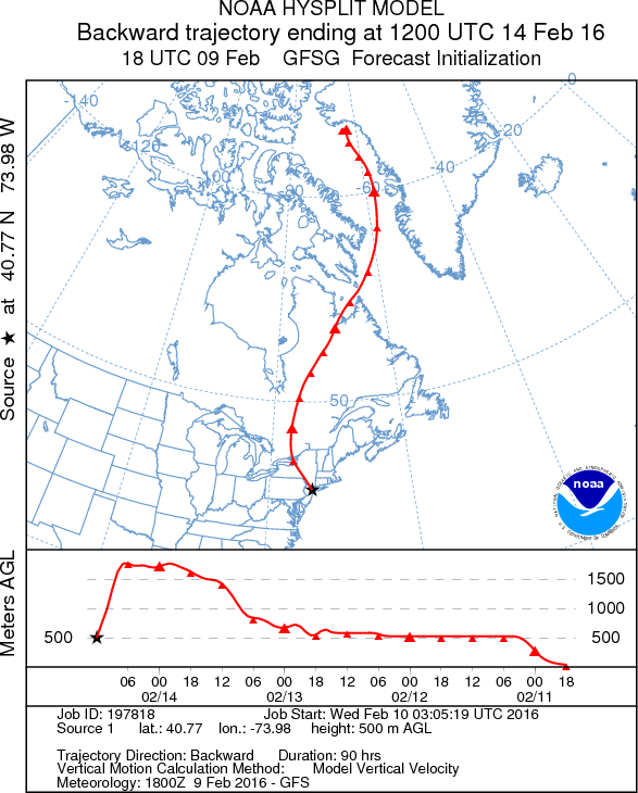
Source for image above: https://twitter.com/TomNiziol/status/697255758757568512
I assume I need to start here? http://ready.arl.noaa.gov/hypub-bin/trajtype.pl
Do I choose "normal"?
I assume GFS on next page? Source location I assume in the Arctic Circle?
Then the Model Run Details and the Display options I'm not sure of.
Thank You.
There is currently a projection of Arctic air to drop down next week and I wanted to see a backwards trajectory of it.
This is from back in February but wanted to know how to create such a map for current projection for next week.
Source for image above: https://twitter.com/TomNiziol/status/697255758757568512
I assume I need to start here? http://ready.arl.noaa.gov/hypub-bin/trajtype.pl
Do I choose "normal"?
I assume GFS on next page? Source location I assume in the Arctic Circle?
Then the Model Run Details and the Display options I'm not sure of.
Thank You.